
Topographic Survey Review for Hillside Building Plans
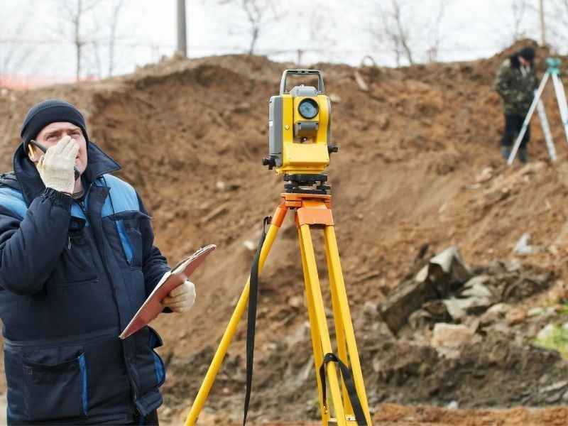
Hillside lots can look great in photos, but they hide a lot of hard truths under the surface. A topographic survey is what turns those hidden slopes into real numbers, so builders know what they are working with before design work starts. Skip this step on a sloped lot, and small surprises tend to turn into big costs later.
Flat land forgives a lot of mistakes. Sloped land does not. A grade that looks gentle from the street can shift sharply once measured, and that shift can change where a house sits, how a driveway runs, and how much a project ends up costing.
Measuring Slope Conditions Before Design Choices
Builders can’t pick a smart spot for a house without knowing the true slope of the land first. A topographic survey measures that slope in exact numbers, showing which parts of a hillside lot are gentle and which parts drop off fast.
This matters early, before anyone draws up plans. A design that works on paper can fall apart once the real grade shows up on site. Builders who skip this step often end up redoing plans midway through, which wastes both time and money.
Slope data also affects how a house sits on its foundation. A steep grade might call for a different foundation type than a mild one, and that decision gets a lot easier once the actual numbers are on hand.
Locating Steep Areas That May Limit Usable Space
Not every part of a sloped lot is equally easy to build on. Survey contours show exactly where the land gets too steep for normal construction, and those areas often end up smaller or more costly to develop than they first appear.
A lot that looks spacious on a map can shrink fast once the steep sections get ruled out. Builders need to know this early, since it changes how much usable space is actually left for a house, a yard, or a driveway.
Steep zones also tend to raise the price of construction. Grading, retaining walls, and extra foundation work all cost more on land that drops off sharply, so knowing where those zones sit helps builders plan a realistic budget from the start.
Supporting Safer Driveway and Access Planning
Getting a car up a hillside driveway sounds simple until the grade gets too steep to handle safely. Elevation data helps teams plan a route that actually works, instead of guessing based on how the land looks while standing on it.
A driveway with too sharp a slope can become dangerous in rain, ice, or snow, and fixing that problem after paving is far more expensive than planning around it early. Survey data shows the exact grade change along any proposed path, so builders can adjust the route before construction starts.
Access planning on a hillside often means finding the one path that balances a safe grade with a reasonable length. That kind of decision needs real numbers, not a guess made while walking the lot.
Helping Engineers Plan Cut and Fill Needs
Most hillside building sites need some reshaping before construction can begin. Topographic information tells engineers exactly how much dirt has to be cut away or added back to create a workable building pad.
Getting this balance right saves money. Cut and fill work that is planned around accurate elevation data usually costs less than work based on rough estimates, since crews know exactly how much material to move before they start. Poor planning here often leads to wasted dirt hauling or last minute grading changes.
The survey also shows engineers where cut and fill zones meet the natural slope, which affects drainage, soil stability, and how a retaining wall might need to be placed.
Details engineers pull from survey data during this stage include:
- Total volume of cut and fill needed
- Slope stability at the edges of graded areas
- Natural drainage paths crossing the building pad
- Elevation differences between the pad and surrounding grade
Reducing Surprises on Sloped Property Projects
Hillside projects have a reputation for going over budget, and unclear ground conditions are usually the reason. A full topographic survey done early can catch most of these issues before they turn into expensive change orders.
Drainage problems, unstable soil, and hidden grade changes tend to show up during construction on sites that skipped a proper survey. By that point, fixing them costs far more than it would have during the planning stage. A clear picture of the land upfront keeps a project closer to its original budget and timeline.
Owners who order a survey before committing to a design also get a better sense of what the land can realistically support. That knowledge helps set expectations early, instead of discovering limits halfway through construction.
Frequently Asked Questions
Why is a topographic survey important for hillside lots?
It shows elevation changes and slope conditions that affect planning, grading, drainage, and construction decisions. Without that data, builders are working from guesses instead of facts.
Can a topographic survey show steep areas?
Yes, contours and elevation points help identify areas with stronger grade changes. Those areas often need extra planning before any construction can begin.
Does hillside construction need accurate survey data?
Yes, sloped sites often require careful measurement before design and grading decisions are made. A small error in the numbers can lead to a much bigger error once building starts.
When should hillside property be surveyed?
It should be surveyed before design, pricing, excavation, or driveway planning begins. Waiting until later usually means paying more to fix decisions made without the right information.