
Building on Hillsides? A Topographic Survey Could Save Thousands
Hillside lots offer great views, privacy, and a unique feel that flat ground cannot match. Many buyers fall in love with the location and assume building will follow a normal process. What they do not see is how the shape of the land changes every part of construction. A topographic survey reveals those hidden details right from the start. It turns guesswork into clear facts and helps you avoid spending far more than you planned.
Without this information, you might base your budget and plans on how the land looks from the road. That view rarely shows the true slopes, low spots, or natural water flow. Those unseen features become major costs once work begins.
Why Hillside Lots Can Look Buildable but Cost Far More Than Expected
From a distance, a sloped lot may seem gentle and easy to work with. It looks like you can simply level a small area and start building. In reality, hillsides have complex shapes that change quickly from one end to the other. Some sections rise sharply while others dip low enough to hold water after rain.
Most people only notice these issues when they bring in heavy equipment. Digging on steep ground takes more time and more care. Moving soil up or down a slope costs more than moving it across flat land. You may also find that the soil is less stable than it looks, which adds work for proper support. These hidden conditions turn a reasonable estimate into a much higher bill.
Reading the Landscape Before Heavy Equipment Arrives
Long before any digging starts, teams need to understand how the land actually works. They look for natural ridges that stay dry and solid, and low areas where water gathers. They follow the paths where rainwater flows across the surface during storms. Even small changes in height can change how water moves and where it ends up.
When you see these patterns clearly, you can plan around them instead of fighting against them. You know which parts of the lot stay stable and which need extra attention. You also know where to keep structures clear to avoid flooding or erosion. This early understanding sets the stage for every decision that follows. You can rely on land elevation details to make choices that fit the natural shape of the site.
Design Decisions That Change Once Accurate Terrain Data Is Available
Architects and engineers often start with general ideas about where to place the house, driveway, and garage. Those ideas shift quickly once they have exact measurements of the land. The main structure may sit higher or lower than first thought to match stable ground. Driveways may curve or change length to avoid steep grades that are hard to drive on.
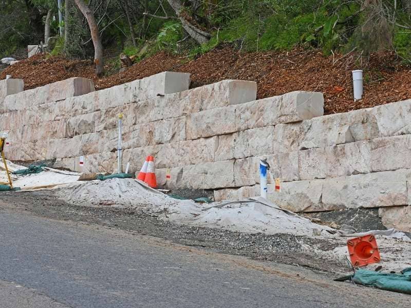
Retaining walls, which are common on hillsides, change in size and placement based on true slopes. Foundations also shift from simple slabs to deeper designs that handle uneven ground. Even the direction the home faces can change to take advantage of natural levels and reduce the amount of digging needed. Every adjustment comes from knowing exactly how the land rises and falls. This information makes designs practical and affordable.
The Construction Budget Isn’t Just Concrete It’s Dirt
On any building project, moving soil is one of the biggest costs. On hillsides, that cost grows much faster. If you guess wrong about how much dirt needs to come out or go in, you face large extra charges. You may need to bring in clean fill from miles away, or pay to haul away excess soil that has nowhere to stay on site.
Steeper slopes also require more careful work to keep the ground from sliding or washing away. This means more labor, more time, and more materials just to prepare the base. When you do not have accurate numbers, contractors often add large safety margins to protect themselves. Those margins become part of your final bill. Clear site contour data removes that uncertainty and lets you plan earthwork with real numbers.
When Spending More on Surveying Results in Spending Less on Construction
Paying for a detailed survey early feels like an extra cost, but it works like insurance against mistakes. It gives you the full picture before you sign contracts or buy materials. You can lock in accurate prices instead of waiting for surprises that pop up halfway through the job.
You avoid redesigning plans after digging starts, and you cut down on change orders that push costs higher. You also keep work moving on schedule because crews follow plans that match the actual land. The money saved on unnecessary grading, extra materials, and delays far outweighs the cost of the survey. It turns a project that could run over budget into one that stays on track from start to finish.
Frequently Asked Questions
Are hillside properties always more expensive to prepare for construction than flat lots?
They usually cost more because of the extra work needed to level ground, control water, and support structures. However, knowing the exact terrain early helps you manage those costs and avoid unexpected charges.
How can elevation changes affect foundation design on residential projects?
Foundations must follow the slope and stay stable. On steep ground, you may need raised footings, deep supports, or stepped designs instead of a simple flat base. These changes come directly from measurements of how the land rises and falls.
Can steep terrain increase the amount of excavation equipment a project requires?
Yes. Moving soil on a slope takes more power and more time. You may need specialized machines or extra safety measures to work safely. Clear terrain data helps you choose the right equipment and schedule it properly.
Do architects use Topographic Survey data differently than grading contractors?
Architects use it to place buildings and plan layouts. Grading contractors use it to calculate how much soil to move and how to shape the ground. Both groups rely on the same set of facts to make their work accurate and efficient.
How early should hillside terrain be evaluated before purchasing land?
Ideally, you should review terrain data before finalizing the purchase. It shows you the true cost of building and helps you decide if the lot fits your budget and plans.
What site conditions usually create the biggest grading expenses on sloped property?
Sharp changes in height, areas that hold water, unstable soil, and slopes steeper than the recommended limits all add work. These conditions often require extra digging, retaining walls, or drainage systems to make the site safe and usable.